On this page, find important information for Pilots, Masters and Pilot Exempt Masters relating to:
- Pilotage Exemptions
- Passage Plans
- Waypoints and
- Towage Vessels
If you require any further information or assistance,
please contact Flinders Ports on +61 8 8447 0611.
Pilotage Exemptions
Flinders Ports is responsible for the safe navigation of commercial vessels in all Flinders Ports owned ports.
Masters wanting to obtain a pilotage exemption for any Flinders Ports port will need to comply with Department for Infrastructure and Transport (DIT) requirements and necessary examinations, including:
- Complete trips as required within a 12-month period and necessary check pilotage(s)
- Complete a Questionnaire and Exemption Chart under Pilot supervision
- Provide evidence of current medical fitness to a specified standard
- Demonstrate familiarity with Flinders Ports regulations and port operating procedures, tug rules, vocabulary, etc
- Submit appropriate application forms obtained from DIT
The exemption certificate will nominate a certain vessel or class of vessel.
Candidates are to contact Flinders Ports to arrange a time with a Flinders Ports Pilot to undertake the assessment. Flinders Ports will generate a letter of recommendation to DIT and the pilot exemption certificate will be approved.
Waypoints
The below tables are the waypoints used by Flinders Ports pilots for entry and exit from Port Adelaide. These are the waypoints for an ECDIS system. The pilot will select from one of the three possible routes for arrival and departure.
Masters of ships are encouraged to use these waypoints for passage planning purposes. The waypoints must be entered accurately and in particular the turn radius is important to show the track that the vessel is expected to take.
The pilot will discuss with the master the best route on each occasion, however masters can expect the following:
- Vessels going to any of the Outer Harbor berths with a draft over 11 meters should plan to use the Adelaide Entry 14.2 meter route.
- Vessels going to any of the Outer Harbor berths with drafts between 9 and 11 meters should plan to use the Adelaide Entry 12 Meter route to waypoint 6.
- Vessels going to or from any of the Inner harbor berths (18 to 20, 27, 29, H, M, Osborne) should plan to use the Adelaide Entry 10 meter route.icon-cir
Waypoints for Adelaide Entry (14.2 meter passage)
Use these waypoints for ships entering the channel at the Entrance Beacon. Normally ships with a draft of over 11 meters (plus allowance for tide).
| Waypoint number | Waypoint name | Lat | Long | Turn radius | Speed to next waypoint |
|---|---|---|---|---|---|
| 0 | Pilot Boarding Ground | 34 49.0 S | 138 20.0 E | Full ahead | |
| 1 | Front Lead | 34 47.05728 S | 138 21.73939 E | 1800 m | Full Ahead |
| 2 | Entrance Beacon | 34 46.84868 S | 138 22.39711 E | 1800 m | Full Ahead |
| 3 | Number 2 Leads | 34 47.56338 S | 138 26.75798 E | 3700 m | 12 knots |
| 4 | Breakwater | 34 47.39804 S | 138 27.67398 E | 1800 m | 10 knots |
| 5 | Signal Station | 34 46.97619 S | 138 28.56627 E | 1800 m | 7 knots |
| 6 | 5 Swinging Basin | 34 46.05498 S | 138 29.21115 E |
Waypoints must be entered into an ECDIS system accurately. Turn Radius must be entered accurately to show the correct turn radii for the passage, and the passage around the bends.
Waypoints for Adelaide Entry (12 meter passage)
Use these waypoints for vessels expecting to enter the channel at number 5 beacon. Normally for vessels with drafts between 9 and 11 meters (plus an allowance for tide).
| Waypoint number | Waypoint name | Lat | Long | Turn radius | Speed to next waypoint |
|---|---|---|---|---|---|
| 0 | Pilot Boarding Ground | 34 49.0 S | 138 20.0 E | Full ahead | |
| 1 | 12 Meter Passage | 34 47.166 S | 138 22.73703 E | 1800 m | Full Ahead |
| 2 | Number 5 Beacon | 34 47.166 S | 138 24.33834 E | 1800 m | Full Ahead |
| 3 | Number 2 Leads | 34 47.56338 S | 138 26.75798 E | 3700 m | 12 knots |
| 4 | Breakwater | 34 47.39804 S | 138 27.67398 E | 1800 m | 10 knots |
| 5 | Signal Station | 34 46.97619 S | 138 28.56627 E | 1800 m | 7 knots |
| 6 | 5 Swinging Basin | 34 46.05498 S | 138 29.21115 E |
Waypoints must be entered into an ECDIS system accurately. Turn Radius must be entered accurately to show the correct turn radii for the passage, and the passage around the bends.
Waypoints for Adelaide Entry (10 meter passage)
Use these waypoints for any vessel expecting to enter the channel between beacons 9 and 11. Normally for vessels with drafts less than 9 meters (plus an allowance for tide) and vessels transiting to Port Adelaide (Inner Harbor).
| Waypoint number | Waypoint name | Lat | Long | Turn radius | Speed to next waypoint |
|---|---|---|---|---|---|
| 0 | Pilot Boarding Ground | 34 49.0 S | 138 20.0 E | Full ahead | |
| 1 | 10 Meter Channel | 34 47.51618 S | 138 24.79393 E | 1800 m | Full Ahead |
| 2 | Number 2 Leads | 34 47.50255 S | 138 27.09494 E | 1800 m | 12 knots |
| 3 | Breakwater | 34 47.39804 S | 138 27.67398 E | 1800 m | 10 knots |
| 4 | Signal Station | 34 46.97619 S | 138 28.56627 E | 1800 m | 7 knots |
| 5 | 5 Swinging Basin | 34 46.14790 S | 138 29.14623 E | 1800 m | 7 knots |
| 6 | Pelican Point | 34 45.45971 S | 138 30.17434 E | 1440 m | 7 knots |
| 7 | Snapper Point | 34 46.02799 S | 138 31.13881 E | 1090 m | 7 knots |
| 8 | Osborne | 34 47.85258 S | 138 30.70688 E | 1800 m | 7 knots |
| 9 | North Arm | 34 48.87187 S | 138 30.87989 E | 2500 m | 7 knots |
| 10 | 27 Berth | 34 49.64776 S | 138 30.48673 E | 1800 m | 4 knots |
| 11 | 2 Swinging Basin | 34 50.17011 S | 138 30.44309 E |
Waypoints must be entered into an ECDIS system accurately. Turn Radius must be entered accurately to show the correct turn radii for the passage, and the passage around the bends.
Swinging Basin Guidelines
This information is to assist masters and Navigation officers when preparing passage plans. Variations may be required based on pilots advice.
Vessels up to 265 meters LOA can swing in number 6 swinging basin immediately off the passenger terminal at number 2 berth. Number 6 swinging basin is 410m wide but some depths are not entirely assured and hence local knowledge is required. Vessels which can safely navigate the 10 meter passage can be safely swung in this area.
Vessels between 265 meters and 350m LOA (and all vessels going to Outer Harbor berths 6,7 and 8) should swing in number 5 swinging basin immediately off number 6 berth, which provides a larger area, known current conditions, and consistent and maintained depths. Number 5 swinging basin is 560 meters wide. Ships with sufficient bow thrusters, pods, suitable twin screw or sufficient tugs may swing either direction. During strong tides the tide will assist the swing bow to port on a flood tide and bow to starboard on an ebb tide.
Number 4 swinging area (off Osborne) is suitable for vessels up to LOA 183 meter. Vessels normally swing on arrival bow to starboard. Vessels that swing on departure can swing either way but normally bow to port.
Number 3 swinging area is 330 meters across. Ships up to 206 meters can swing either way. The largest ships swung in this area are panamax (228 meter).
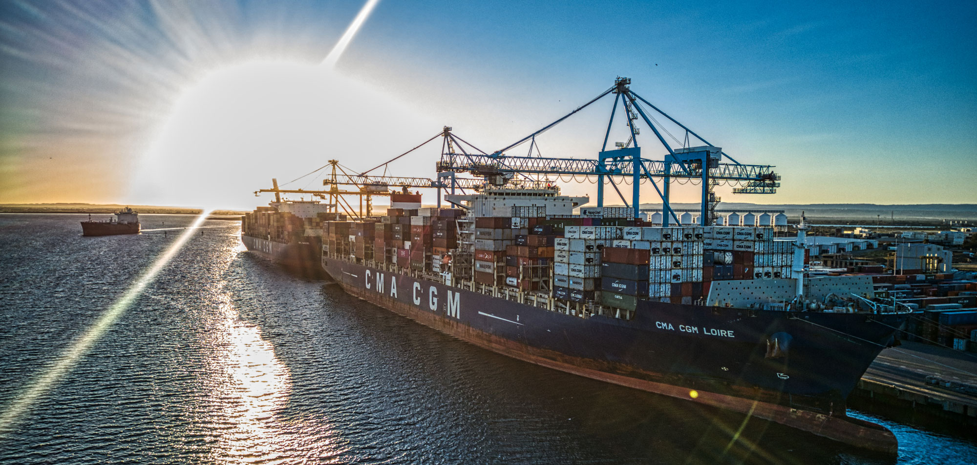
Towage Vessels for Flinders Ports in South Australia
Flinders Ports utilises a fleet of reliable towage vessel from Svitzer Australia and Port Lincoln Tugs at its ports.
| Home Port | Tug Name | Year Built | LOA (metres) | M/E Power | Bollard Pull | Propellers / Type | Company | Remarks |
|---|---|---|---|---|---|---|---|---|
| Port Adelaide | Barunga | 2003 | 24.55 | 2X 2100 kW | 63mt astern 70mt ahead | 2X Z-peller Azimuth stern drive | Svitzer | Fire fighting equipped |
| Port Adelaide | Svitzer Heron | 2012 | 31.57 | 2X 1838 kW | 65mt astern 65mt ahead | 2 / Z-peller Azimuth stern drive | Svitzer | Emergency Tow (AMSA) & FiFi1 |
| Port Adelaide | SL Endeavour | 2010 | 24.47 | 2X 2100 kW | 63mt astern 70mt ahead | 2X Z-peller Azimuth stern drive | Svitzer | Fire fighting equipped |
| Port Adelaide | Sheringa | 1985 | 31.95 | 2X 1342kW | 47mt ahead 45mt astern | 2 / Z-peller Azimuth stern drive | PLT | Emergency Tow (Salvage) & FiFi1 harbour towage |
| Ardrossan | ||||||||
| Wallaroo | Tickera | 1976 | 28.98 | 2X 1250 bhp | 42t | 2 nozzles (steerable) | PLT | Harbour towage |
| Port Pirie | Wonga | 1983 | 32.17 | 2X 1300 bhp | 48mt ahead 47mt astern | 2X Z-peller Azimuth stern drive | Svitzer | Fire fighting equipped |
| Port Pirie | Svitzer Ginga | 2006 | 30.00 | 2X | 55mt ahead 52mt astern | 2X Z-peller | Svitzer | FiFi equipped |
| Port Pirie | Svitzer Larrakia | 2006 | 30.00 | 2X 1685kW | 55mt ahead | 2X Z-peller | Svitzer | FiFi equipped |
| Whyalla | Engage Crusader | 1986 | 33.56 | 2 x 1343kW | 44.75 tonnes Astern, 48.5 tonnes ahead | 2X Z-peller Azimuth stern drive | Engage | Barging/Harbour towage |
| Whyalla | Engage Vanquish | 2005 | 27.7 | 3X 1323kW | 57.9mt ahead 58.8mt astern | 3X Z-peller Azimuth tractor drive | Engage | Barging & harbour towage Fifi equipped |
| Whyalla | Engage Vanguard | 2005 | 27.7 | 3X 1323kW | 57.9mt ahead 58.8mt astern | 3X Z-peller Azimuth tractor drive | Engage | Barging & harbour towage Fifi equipped |
| Whyalla | Engage Challenger | 2010 | 27.9 | 2X 1323kW | 49.3mt ahead 45.8mt astern | 2 X Azimuth stern drive | Engage | Barging & harbour towage Fifi equipped |
| Whyalla | ASD Aquilion | 2020 | 46.00 | 2X 2237kW | 80mt ahead 72.8mt astern | 2 X Azimuth stern drive | Engage | Barging & harbour towage Fifi 1 equipped |
| Port Lincoln | Bulimba | 1979 | 29 | 2X 1250 bhp | 41t | 2 / nozzles (steerable) | PLT | Supplementary '2nd' tug / fire fighting equipped |
| Port Lincoln | Kimba | 1989 | 23.95 | 1938kw | 30t | 2X Z-peller | PLT | Temp support prior relocation interstate |
| Port Lincoln | Wyong | 1992 | 32.00 | 2X 1800 hp | 48 | Twin azimuth | PLT | Harbour towage |
| Thevenard | Pelsaert | 1987 | 23.95 | 2382hp | 30t | 2X Z-peller | PLT | Supplementary '2nd' tug |
| Thevenard | Carawa | 1987 | 23.88 | 2382hp | 30t | 2 X Z-peller | PLT | Primary tug |